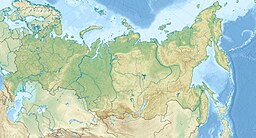
坎巴利內火山
外觀
| 坎巴利內火山 (Kambalny) | |
|---|---|
 | |
| 最高點 | |
| 海拔 | 2,156公尺(7,073英尺)[1] |
| 地形突起度 | 1,970公尺(6,460英尺)[2][3] |
| 列表 | Ultra |
| 座標 | 51°18′20″N 156°52′31″E / 51.30556°N 156.87528°E[1] |
| 地理 | |
| 位置 | 俄羅斯堪察加半島 |
| 地質 | |
| 岩石年代 | 全新世 |
| 山脈類型 | 複式火山 |
| 最近噴發 | 2017年3月24日 |
坎巴利內山(Камбальная Сопка)是俄羅斯的火山,位於堪察加半島南部,海拔高度2,156米,山體在全新世形成。1769年火山噴發後,坎巴利內山立刻沉寂下來,沒有了火山活動。然而,歷經近250年的休眠,2017年3月24日,山體再度噴發。
參見
[編輯]參考文獻
[編輯]- ^ 1.0 1.1 Ivanov, Anton; Shoba, Serghei; Krasilnikov, Pavel. A pedogeographical view of volcanic soils under cold humid conditions: the Commander Islands. Geoderma. December 2014,. 235–236: 50. doi:10.1016/j.geoderma.2014.06.031.
- ^ "Russia: Kamchatka and the Russian Pacific Islands Ultra-Prominence Page" (頁面存檔備份,存於網際網路檔案館) Peaklist.org. The prominence value given here (1,970 m) is based on a summit elevation of 2,161 m. Retrieved 2011-11-26.
- ^ "Vulkan Kambalny, Russia" (頁面存檔備份,存於網際網路檔案館) Peakbagger.com. The prominence value given here (1,970 m) is based on a summit elevation of 2,161 m. Retrieved 2011-11-26.
參考資料
[編輯]- Ponomareva, Vera V.; Melekestsev, Ivan V.; Dirksen, Oleg V. Sector collapses and large landslides on Late Pleistocene–Holocene volcanoes in Kamchatka, Russia. Journal of Volcanology and Geothermal Research. November 2006, 158 (1–2): 117–138. Bibcode:2006JVGR..158..117P. doi:10.1016/j.jvolgeores.2006.04.016.
| 這是一篇與俄羅斯地理相關的小作品。您可以透過編輯或修訂擴充其內容。 |

