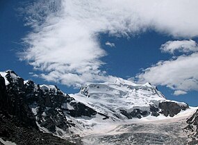
大孔班山
外觀
| 大孔班山 | |
|---|---|
 大孔班山 | |
| 別名 | Combin de Grafeneire |
| 最高點 | |
| 海拔 | 4,314米(14,154英尺) |
| 地形突起度 | 1517 m ↓ Fenêtre de Durand[1] |
| 地形孤立度 | 26.4 km → Dent Blanche[2] |
| 母峰 | 羅莎峰 |
| 列表 | 阿爾卑斯山脈山峰列表 |
| 座標 | 45°56′15″N 7°17′57″E / 45.93750°N 7.29917°E |
| 地理 | |
| 位置 | 瑞士瓦萊州 |
| 所屬山脈 | 本寧阿爾卑斯山脈 |
| 地形圖 | Swisstopo 1346 Chanrion |
| 攀山 | |
| 首次登頂 | 1859年7月30日 |
大孔班山(Grand Combin)是阿爾卑斯山脈的山峰,位在瑞士境內,海拔4,314公尺[3]。魏斯峰是本寧阿爾卑斯山脈的一部分,位於瓦萊州。
參考資料
[編輯]- ^ Retrieved from the Swisstopo topographic maps. The key col is the Fenêtre de Durand (2,797 m).
- ^ Retrieved from Google Earth. The nearest point of higher elevation is west of the Dent Blanche.
- ^ Considering peaks with at least 300 metres prominence, it is the eighth highest.
| 這是一篇與瑞士地理相關的小作品。您可以透過編輯或修訂擴充其內容。 |

