
莫伯利 (密蘇里州)
| 莫伯利 Moberly | |
|---|---|
| 城市 | |
 | |
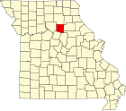
 莫伯利在蘭道夫縣及密蘇里州的位置(以紅色標示) | |
 莫伯利 莫伯利在密蘇里州的位置 | |
| 坐標:39°25′04″N 92°26′11″W / 39.41778°N 92.43639°W | |
| 國家 | 美國 |
| 州份 | 密蘇里州 |
| 縣 | 蘭道夫縣 |
| 面積 | |
| • 總計 | 34.24 平方公里(13.22 平方英里) |
| • 陸地 | 34.13 平方公里(13.18 平方英里) |
| • 水域 | 0.11 平方公里(0.04 平方英里) |
| 海拔 | 266 公尺(873 英尺) |
| 人口(2020)[1] | |
| • 總計 | 13,783人 |
| • 密度 | 403人/平方公里(1,043人/平方英里) |
| 時區 | CST(UTC-6) |
| • 夏時制 | CDT(UTC-5) |
| 郵區編號 | 65270 |
| 電話區號 | 573 |
| GNIS ID | 2395362[2] |
莫伯利(英語:Moberly)是位於美國密蘇里州蘭道夫縣的城市。
氣候[編輯]
| 莫伯利 (密蘇里州),1991–2020年正常值,1936年至今極端數據 | |||||||||||||
|---|---|---|---|---|---|---|---|---|---|---|---|---|---|
| 月份 | 1月 | 2月 | 3月 | 4月 | 5月 | 6月 | 7月 | 8月 | 9月 | 10月 | 11月 | 12月 | 全年 |
| 歷史最高溫 °F(°C) | 76 (24) |
82 (28) |
87 (31) |
92 (33) |
96 (36) |
102 (39) |
112 (44) |
108 (42) |
102 (39) |
96 (36) |
83 (28) |
73 (23) |
112 (44) |
| 平均高溫 °F(°C) | 37.1 (2.8) |
42.2 (5.7) |
53.9 (12.2) |
64.7 (18.2) |
74.2 (23.4) |
82.8 (28.2) |
87.0 (30.6) |
85.6 (29.8) |
78.2 (25.7) |
66.8 (19.3) |
53.2 (11.8) |
42.0 (5.6) |
64.0 (17.8) |
| 日均氣溫 °F(°C) | 28.0 (−2.2) |
32.5 (0.3) |
43.8 (6.6) |
54.4 (12.4) |
64.5 (18.1) |
73.2 (22.9) |
77.3 (25.2) |
75.7 (24.3) |
67.8 (19.9) |
56.3 (13.5) |
43.5 (6.4) |
33.3 (0.7) |
54.2 (12.3) |
| 平均低溫 °F(°C) | 18.9 (−7.3) |
22.7 (−5.2) |
33.6 (0.9) |
44.1 (6.7) |
54.9 (12.7) |
63.7 (17.6) |
67.5 (19.7) |
65.7 (18.7) |
57.3 (14.1) |
45.9 (7.7) |
33.8 (1.0) |
24.7 (−4.1) |
44.4 (6.9) |
| 歷史最低溫 °F(°C) | −21 (−29) |
−19 (−28) |
−12 (−24) |
17 (−8) |
28 (−2) |
40 (4) |
48 (9) |
44 (7) |
32 (0) |
18 (−8) |
−4 (−20) |
−20 (−29) |
−21 (−29) |
| 平均降水量 英寸(mm) | 1.87 (47) |
2.06 (52) |
3.26 (83) |
4.58 (116) |
5.13 (130) |
5.16 (131) |
4.53 (115) |
3.94 (100) |
3.95 (100) |
3.38 (86) |
2.65 (67) |
2.19 (56) |
42.70 (1,085) |
| 平均降雪量 英寸(cm) | 5.6 (14) |
3.2 (8.1) |
1.2 (3.0) |
0.2 (0.51) |
0.0 (0.0) |
0.0 (0.0) |
0.0 (0.0) |
0.0 (0.0) |
0.0 (0.0) |
0.1 (0.25) |
0.7 (1.8) |
4.0 (10) |
15.1 (38) |
| 平均降水天數(≥ 0.01 in) | 6.4 | 6.8 | 9.2 | 10.9 | 12.1 | 9.6 | 7.9 | 7.8 | 7.4 | 8.7 | 7.3 | 7.0 | 101.1 |
| 平均降雪天數(≥ 0.1 in) | 2.3 | 1.9 | 0.6 | 0.1 | 0.0 | 0.0 | 0.0 | 0.0 | 0.0 | 0.1 | 0.3 | 2.0 | 7.3 |
| 數據來源:NOAA[3][4] | |||||||||||||
人口[編輯]
| 歷史人口數 | |||
|---|---|---|---|
| 調查年 | 人口 | %± | |
| 1870年 | 1,514 | — | |
| 1880年 | 6,070 | 300.9% | |
| 1890年 | 8,215 | 35.3% | |
| 1900年 | 8,012 | −2.5% | |
| 1910年 | 10,923 | 36.3% | |
| 1920年 | 12,808 | 17.3% | |
| 1930年 | 13,772 | 7.5% | |
| 1940年 | 12,920 | −6.2% | |
| 1950年 | 13,115 | 1.5% | |
| 1960年 | 13,170 | 0.4% | |
| 1970年 | 12,988 | −1.4% | |
| 1980年 | 13,418 | 3.3% | |
| 1990年 | 12,839 | −4.3% | |
| 2000年 | 11,945 | −7.0% | |
| 2010年 | 13,974 | 17.0% | |
| 2020年 | 13,783 | −1.4% | |
| source:[5][6][7] | |||
根據2020年美國人口普查的數據,莫伯利的面積為34.24平方千米,當中陸地面積為34.13平方千米,而水域面積為0.11平方千米。當地共有人口13783人,而人口密度為每平方千米403人。[1]
參考文獻[編輯]
- ^ 1.0 1.1 2020 U.S. Gazetteer Files. United States Census Bureau. [2022-05-21].
- ^ Moberly. Geographic Names Information System. United States Geological Survey.
- ^ NowData – NOAA Online Weather Data. National Oceanic and Atmospheric Administration. [2021-08-02].
- ^ Station: Moberly, MO. U.S. Climate Normals 2020: U.S. Monthly Climate Normals (1991-2020). National Oceanic and Atmospheric Administration. [2021-08-02].
- ^ Missouri Population 1900 - 1990 (PDF). Missouri Census Data Center. [2010-02-28]. (原始內容 (CSV)存檔於2014-07-04).
- ^ Census of Population and Housing, 1890, Final Reports Volume 1. United States Census Bureau. 1895 [2015-05-01].
- ^ Census of Population and Housing, 1880, Volume 1 Statistics of the Population of the United States, General Population Table 3. United States Census Bureau. 1881 [1 May 2015].
| |||||||||||||||||||||||||||||||||||
| 這是一篇密蘇里州的地理小作品。您可以透過編輯或修訂擴充其內容。 |