羅些
外观
| 羅些 Rozelle | |
|---|---|
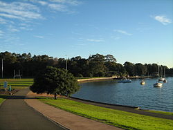
 英皇佐治公園 | |
| 坐标:33°51′54″S 151°10′2″E / 33.86500°S 151.16722°E | |
| 国家 | |
| 一级行政区 | 新南威爾士州 |
| 地方政府区域 | 內西區議局 |
| 建立 | 1892年 |
| 面积 | |
| • 总计 | 1.9 平方公里(0.7 平方英里) |
| 郵政編碼 | 2039 |
| 位置 | 4公里(2.5英里) (距雪梨商業中心區西) |
| 城市 | 雪梨 |
| 州選區 | 巴免 |
| 聯邦選區 | 格賴恩德勒 |
羅些[1][註 1](英語:Rozelle)是澳洲新南威爾斯州雪梨內西區的一個市區,位於雪梨商業中心區以西4公里(2.5英里)處,內西區議局地方政府行政區內。
學校
[编辑]教堂
[编辑]圖集
[编辑]-
Merton Estate Hotel
-
達德素酒樓(Tattersalls Hotel)
-
Bald Rock Hotel
-
Iron Cove Bridge
-
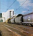
羅些調車場,攝於1977年
-
羅些公立學校
-
加利奧雲酒樓(Garry Owen Hotel)
-
聖公會聖多馬堂
參見
[编辑]註釋
[编辑]參考
[编辑]- ^ Page 7. 廣益華報 The Chinese Australian Herald. 1907-08-03 [2024-04-14].
- ^ Page 2. 東華報 Tung Wah Times. 1916-06-17 [2024-04-14].
書目
[编辑]- The Heritage of Australia, Macmillan Company, 1981, ISBN 0-333-33750-6
- Solling, M; Reynolds, P; Leichhardt: On the margins of the city, Allen & Unwin, 1997, ISBN 1-86448-408-X.
- Lawrence, J; Warne, C; A Pictorial History of Balmain to Glebe, Kingsclear Books, 1995, ISBN 0-908272-40-5.
外部連結
[编辑]- John Williams. Rozelle. Dictionary of Sydney. 2010 [29 September 2015]. (原始内容存档于2024-04-18). [CC-By-SA]
- Local Images at InnerWest ImageBank
- Local History Collection, Leichhardt Council (页面存档备份,存于互联网档案馆)


