
File:1902 Subig Bay (Subic Bay) Luzon, Philippines nautical chart 4254, by Manila Sub Office, United States Coast and Geodetic Survey.jpg

本预览的尺寸:476 × 600像素。 其他分辨率:190 × 240像素 | 381 × 480像素 | 610 × 768像素 | 813 × 1,024像素 | 1,626 × 2,048像素 | 2,672 × 3,366像素。
原始文件 (2,672 × 3,366像素,文件大小:1.21 MB,MIME类型:image/jpeg)
摘要
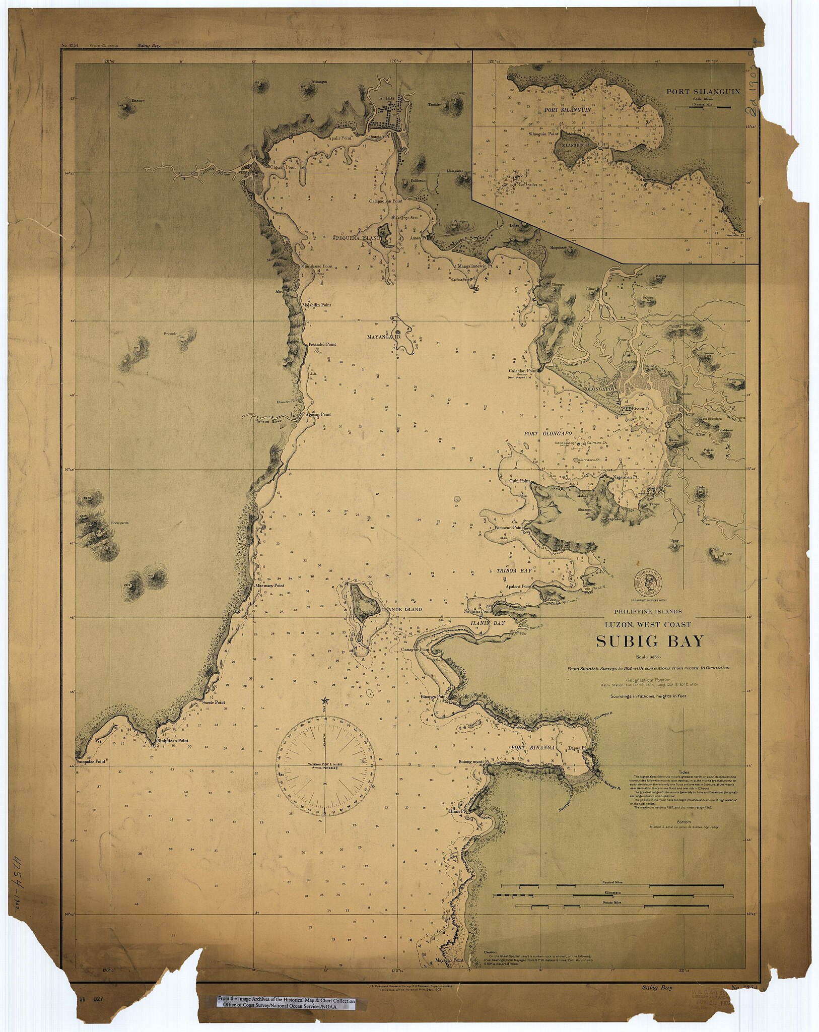
Scanned image of US Coast & Geodetic Survey Manila Office nautical chart #4254 Subig (Subic) Bay, Luzon, Philippines, 1902.
From the Image Archives of the Historical Map & Chart Collection archive copy at the Wayback Machine/Office of Coast Survey/National Ocean Service/NOAA/United States government. Converted from MrSID to JPEG format for upload to Commons.
_4254,_by_Manila_Sub_Office,_United_States_Coast_and_Geodetic_Survey_(cropped).jpg)
_Luzon,_Philippines_nautical_chart_4254,_by_Manila_Sub_Office,_United_States_Coast_and_Geodetic_Survey.jpg?uselang=zh)
_Luzon,_Philippines_nautical_chart_4254,_by_Manila_Sub_Office,_United_States_Coast_and_Geodetic_Survey.jpg?uselang=zh)
_Luzon,_Philippines_nautical_chart_4254,_by_Manila_Sub_Office,_United_States_Coast_and_Geodetic_Survey.jpg?action=history&uselang=zh)
_Luzon,_Philippines_nautical_chart_4254,_by_Manila_Sub_Office,_United_States_Coast_and_Geodetic_Survey.jpg)
许可协议
本图像属于公有领域,因该作品最初来自于美国国家海洋和大气管理局职员的职务作品。
|
文件历史
点击某个日期/时间查看对应时刻的文件。
| 日期/时间 | 缩略图 | 大小 | 用户 | 备注 | |
|---|---|---|---|---|---|
| 当前 | 2006年3月17日 (五) 01:02 | | 2,672 × 3,366(1.21 MB) | Cdc~commonswiki | Scanned image of US Coast & Geodetic Survey Manila Office nautical chart #4254 Subig (Subic) Bay, Luzon, Philippines, 1902. From the Image Archives of the [http://chartmaker.ncd.noaa.gov/csdl/ctp/abstract.htm Historical Map & Chart Collection]/Office of |
文件用途
以下页面使用本文件:
全域文件用途
以下其他wiki使用此文件:
- ast.wikipedia.org上的用途
- da.wikipedia.org上的用途
- en.wikipedia.org上的用途
- es.wikipedia.org上的用途
- fr.wikipedia.org上的用途
- id.wikipedia.org上的用途
- ja.wikipedia.org上的用途
- nl.wikipedia.org上的用途
- no.wikipedia.org上的用途
- pt.wikipedia.org上的用途
- ru.wikipedia.org上的用途
- sv.wikipedia.org上的用途
- tl.wikipedia.org上的用途
- vi.wikipedia.org上的用途
- www.wikidata.org上的用途
_Luzon,_Philippines_nautical_chart_4254,_by_Manila_Sub_Office,_United_States_Coast_and_Geodetic_Survey.jpg)