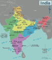
File:Map of India WV.svg
外觀

此 SVG 檔案的 PNG 預覽的大小:513 × 599 像素。 其他解析度:205 × 240 像素 | 411 × 480 像素 | 658 × 768 像素 | 877 × 1,024 像素 | 1,754 × 2,048 像素 | 1,251 × 1,461 像素。
原始檔案 (SVG 檔案,表面大小:1,251 × 1,461 像素,檔案大小:923 KB)
檔案歷史
點選日期/時間以檢視該時間的檔案版本。
| 日期/時間 | 縮圖 | 尺寸 | 使用者 | 備註 | |
|---|---|---|---|---|---|
| 目前 | 2021年1月16日 (六) 14:38 |  | 1,251 × 1,461(923 KB) | Sbb1413 | Updated to include new jurisdictions, plus the addition of union territories. |
| 2016年1月25日 (一) 12:58 |  | 1,251 × 1,461(939 KB) | Csyogi | Telangana state update | |
| 2013年12月15日 (日) 10:16 |  | 1,251 × 1,461(931 KB) | Saqib | typo | |
| 2013年6月8日 (六) 22:14 |  | 1,251 × 1,461(931 KB) | Saqib | removed hatching | |
| 2012年12月15日 (六) 18:05 |  | 1,251 × 1,461(929 KB) | OgreBot | (BOT): Reverting to most recent version before archival | |
| 2012年12月15日 (六) 18:04 |  | 1,251 × 1,461(848 KB) | OgreBot | (BOT): Uploading old version of file from wts.wikivoyage; originally uploaded on 2011-10-22 23:00:45 by (WT-shared) Joelf | |
| 2012年12月15日 (六) 18:04 |  | 744 × 1,052(910 KB) | OgreBot | (BOT): Uploading old version of file from wts.wikivoyage; originally uploaded on 2009-08-25 20:07:33 by (WT-shared) Cacahuate | |
| 2012年12月15日 (六) 18:04 |  | 744 × 1,052(935 KB) | OgreBot | (BOT): Uploading old version of file from wts.wikivoyage; originally uploaded on 2009-08-25 05:42:19 by (WT-shared) Ravikiranr | |
| 2012年12月15日 (六) 18:04 |  | 744 × 1,052(913 KB) | OgreBot | (BOT): Uploading old version of file from wts.wikivoyage; originally uploaded on 2009-08-22 20:29:43 by (WT-shared) Cacahuate | |
| 2012年11月25日 (日) 21:52 |  | 1,251 × 1,461(929 KB) | MGA73bot2 | {{BotMoveToCommons|wts.oldwikivoyage|year={{subst:CURRENTYEAR}}|month={{subst:CURRENTMONTHNAME}}|day={{subst:CURRENTDAY}}}} == {{int:filedesc}} == {{Information |description=Map of India. A map of India's regions, states and metropolis', India * Map of... |
檔案用途
下列頁面有用到此檔案:
全域檔案使用狀況
以下其他 wiki 使用了這個檔案:
- en.wikipedia.org 的使用狀況
- es.wikipedia.org 的使用狀況
- nl.wikivoyage.org 的使用狀況


