
File:Aerial view of Pawpaw Area from NPS exhibit.jpg

預覽大小:800 × 598 像素。 其他解析度:320 × 239 像素 | 640 × 478 像素 | 1,024 × 765 像素 | 1,280 × 956 像素 | 2,560 × 1,912 像素 | 3,936 × 2,940 像素。
原始檔案 (3,936 × 2,940 像素,檔案大小:6.07 MB,MIME 類型:image/jpeg)
摘要
| 描述 |
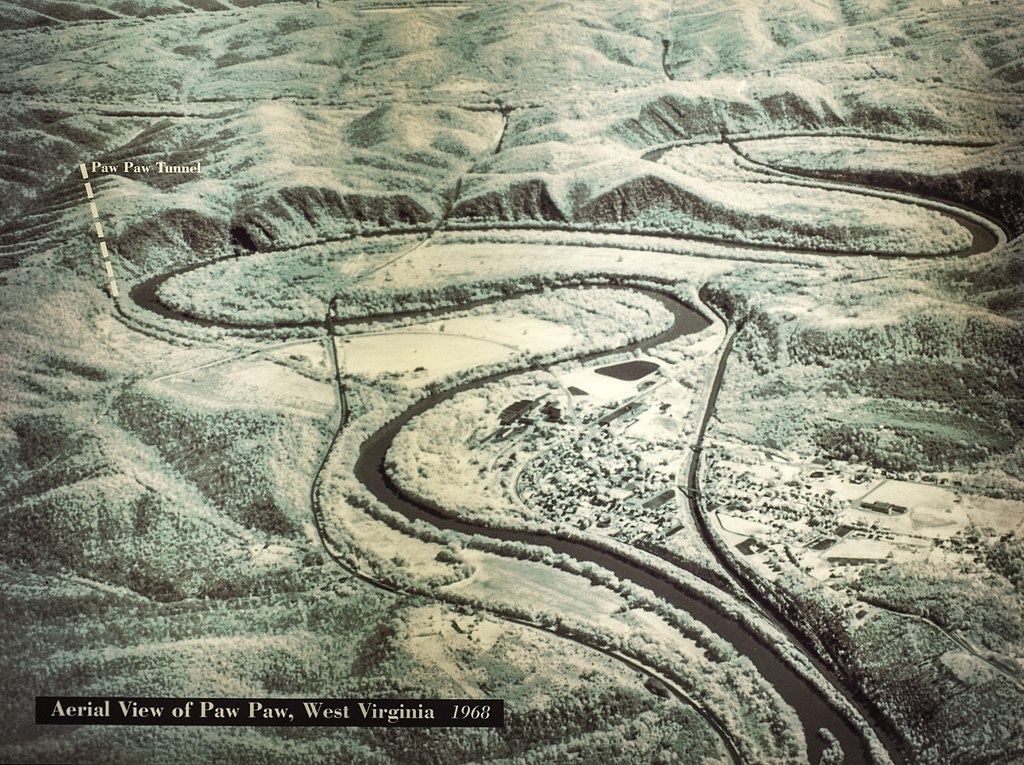
English: Aerial view of the Paw Paw, West Virginia area, showing location of the Paw Paw Tunnel on the Chesapeake and Ohio Canal. The cliffs on the Maryland side of the Potomac River were the reason that the canal engineers (mainly Charles B Fisk) built the tunnel. |
|||
| 日期 | ||||
| 來源 | U.S. National Park Service, Canal Place museum, Cumberland, Maryland. | |||
| 作者 | National Park Service | |||
| 授權許可 (重用此檔案) |
|
檔案歷史
點選日期/時間以檢視該時間的檔案版本。
| 日期/時間 | 縮圖 | 尺寸 | 使用者 | 備註 | |
|---|---|---|---|---|---|
| 目前 | 2014年8月1日 (五) 14:07 | | 3,936 × 2,940(6.07 MB) | Bonnachoven | {{Information |Description ={{en|1=Aerial view of the Pawpaw area, showing place where Pawpaw tunnel is. Note on the MD side of the river, the cliffs which were the reason for the canal engineers (mainly Charles B Fisk) to build the tunnel. }} |Sour... |
檔案用途
下列頁面有用到此檔案:
全域檔案使用狀況
以下其他 wiki 使用了這個檔案:
- en.wikipedia.org 的使用狀況