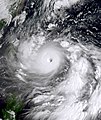
File:Hinnamnor 2022-09-01 0000Z.jpg
外觀

預覽大小:480 × 600 像素。 其他解析度:192 × 240 像素 | 384 × 480 像素 | 614 × 768 像素 | 819 × 1,024 像素 | 1,638 × 2,048 像素 | 3,200 × 4,000 像素。
原始檔案 (3,200 × 4,000 像素,檔案大小:15.46 MB,MIME 類型:image/jpeg)
檔案歷史
點選日期/時間以檢視該時間的檔案版本。
| 日期/時間 | 縮圖 | 尺寸 | 用戶 | 備註 | |
|---|---|---|---|---|---|
| 目前 | 2024年9月7日 (六) 17:03 |  | 3,200 × 4,000(15.46 MB) | Zzzs | unexplained revert |
| 2024年9月7日 (六) 12:38 |  | 1,550 × 2,000(4.36 MB) | Phanfone Vongfong 2014 | Reverted to version as of 15:04, 25 May 2023 (UTC) | |
| 2023年10月20日 (五) 19:44 |  | 3,200 × 4,000(15.46 MB) | TheWxResearcher | m | |
| 2023年10月20日 (五) 19:34 |  | 3,200 × 4,000(15.45 MB) | TheWxResearcher | Color correction. | |
| 2023年5月27日 (六) 21:38 |  | 2,500 × 3,200(9.6 MB) | TheWxResearcher | Reverted to version as of 16:37, 22 January 2023 (UTC) | |
| 2023年5月25日 (四) 15:04 |  | 1,550 × 2,000(4.36 MB) | Papacyclones | Reverted to version as of 02:07, 1 September 2022 (UTC) | |
| 2023年1月22日 (日) 16:37 |  | 2,500 × 3,200(9.6 MB) | TheWxResearcher | Cropped, okay definitely the last update not going to touch it anymore. | |
| 2023年1月22日 (日) 16:34 |  | 2,700 × 3,200(10.42 MB) | TheWxResearcher | I reprojected this image onto a flat map like worldview so the typhoon won't appear slanted, this will be the last update on this image. | |
| 2022年12月14日 (三) 20:28 |  | 2,500 × 3,300(9.29 MB) | TheWxResearcher | m | |
| 2022年12月14日 (三) 19:07 |  | 2,500 × 3,300(8.78 MB) | TheWxResearcher | 500m resolution and focused more on the Typhoon |
檔案用途
下列2個頁面有用到此檔案:
全域檔案使用狀況
以下其他 wiki 使用了這個檔案:
- en.wikipedia.org 的使用狀況
- es.wikipedia.org 的使用狀況
- fa.wikipedia.org 的使用狀況
- he.wikipedia.org 的使用狀況
- ja.wikipedia.org 的使用狀況
- ko.wikipedia.org 的使用狀況
- pt.wikipedia.org 的使用狀況
- th.wikipedia.org 的使用狀況
- uk.wikipedia.org 的使用狀況
- vi.wikipedia.org 的使用狀況
- www.wikidata.org 的使用狀況
- zh-min-nan.wikipedia.org 的使用狀況


