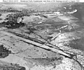
File:Aerial view of Henderson Field, Guadalcanal, in late August 1942.jpg
外觀

預覽大小:751 × 599 像素。 其他解析度:301 × 240 像素 | 602 × 480 像素 | 962 × 768 像素 | 1,280 × 1,021 像素 | 2,560 × 2,043 像素 | 5,694 × 4,544 像素。
原始檔案 (5,694 × 4,544 像素,檔案大小:9.65 MB,MIME 類型:image/jpeg)
檔案歷史
點選日期/時間以檢視該時間的檔案版本。
| 日期/時間 | 縮圖 | 尺寸 | 用戶 | 備註 | |
|---|---|---|---|---|---|
| 目前 | 2017年1月30日 (一) 18:00 |  | 5,694 × 4,544(9.65 MB) | Cobatfor | new NHHC file |
| 2006年6月22日 (四) 22:28 |  | 721 × 570(104 KB) | Cla68 | == Summary == Aerial view of Henderson Field on Guadalcanal, late August 1942. The view looks northwest with the Lunga River and Lunga Point at the top of the image. Several aircraft are parked to the left. U.S. Navy photo #80-G-16312, now in the Natio | |
| 2006年6月22日 (四) 14:52 |  | 740 × 615(143 KB) | Cla68 | Aerial view of Henderson Field on Guadalcanal, late August 1942. The view looks northwest with the Lunga River and Lunga Point at the top of the image. Several aircraft are parked to the left. U.S. Navy photo #80-G-16312, now in the National Archives. |
檔案用途
下列頁面有用到此檔案:
全域檔案使用狀況
以下其他 wiki 使用了這個檔案:
- ast.wikipedia.org 的使用狀況
- azb.wikipedia.org 的使用狀況
- cs.wikipedia.org 的使用狀況
- da.wikipedia.org 的使用狀況
- de.wikipedia.org 的使用狀況
- en.wikipedia.org 的使用狀況
- es.wikipedia.org 的使用狀況
- eu.wikipedia.org 的使用狀況
- fa.wikipedia.org 的使用狀況
- fr.wikipedia.org 的使用狀況
- he.wikipedia.org 的使用狀況
- hr.wikipedia.org 的使用狀況
- hu.wikipedia.org 的使用狀況
- id.wikipedia.org 的使用狀況
- it.wikipedia.org 的使用狀況
- ja.wikipedia.org 的使用狀況
- ka.wikipedia.org 的使用狀況
- ml.wikipedia.org 的使用狀況
- pl.wikipedia.org 的使用狀況
- pt.wikipedia.org 的使用狀況
- ro.wikipedia.org 的使用狀況
- ru.wikipedia.org 的使用狀況
- sv.wikipedia.org 的使用狀況
- uk.wikipedia.org 的使用狀況
- vi.wikipedia.org 的使用狀況
- www.wikidata.org 的使用狀況


