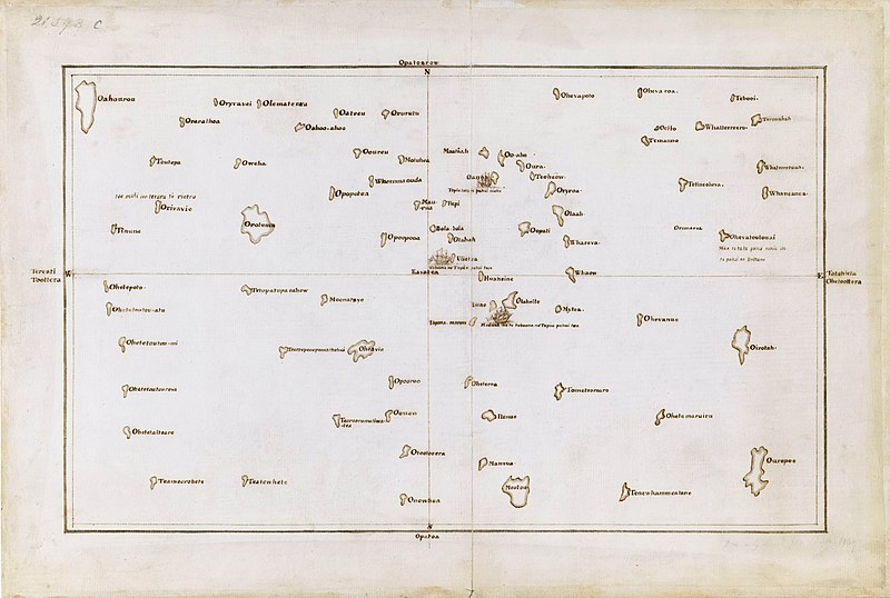
File:Tupaia's map, c. 1769.jpg
外觀

預覽大小:800 × 538 像素。 其他解析度:320 × 215 像素 | 640 × 430 像素 | 1,024 × 688 像素 | 1,280 × 860 像素 | 2,560 × 1,720 像素 | 7,657 × 5,145 像素。
原始檔案 (7,657 × 5,145 像素,檔案大小:15.67 MB,MIME 類型:image/jpeg)
檔案歷史
點選日期/時間以檢視該時間的檔案版本。
| 日期/時間 | 縮圖 | 尺寸 | 用戶 | 備註 | |
|---|---|---|---|---|---|
| 目前 | 2021年9月23日 (四) 02:03 |  | 7,657 × 5,145(15.67 MB) | Capmo | Cropped 4 % horizontally, 6 % vertically using CropTool with lossless mode. |
| 2019年12月7日 (六) 00:15 |  | 8,000 × 5,484(15.06 MB) | Adjutor | Newer image from the British Library https://www.bl.uk/collection-items/the-society-islands accessed 07 December 2019. Format - Pen and Ink, Map; Creator - James Cook, Tupaia Add. MS 21593 C; Created 1769 "This is a view of the Society Islands by Captain James Cook, who completed his first exploration of the Pacific Ocean from 1769 to 1771. The chart is a copy of an original document by Tupaia, a priest and leader of the island of Ra’iatea. He was enlisted by Cook to navigate HMS Endeavour to... | |
| 2017年3月16日 (四) 02:50 |  | 1,600 × 975(371 KB) | KAVEBEAR | ||
| 2017年3月16日 (四) 02:46 |  | 801 × 488(84 KB) | KAVEBEAR |
檔案用途
下列頁面有用到此檔案:
全域檔案使用狀況
以下其他 wiki 使用了這個檔案:
- de.wikipedia.org 的使用狀況
- en.wikipedia.org 的使用狀況
- es.wikipedia.org 的使用狀況
- fa.wikipedia.org 的使用狀況
- id.wikipedia.org 的使用狀況
- it.wikipedia.org 的使用狀況
- no.wikipedia.org 的使用狀況

