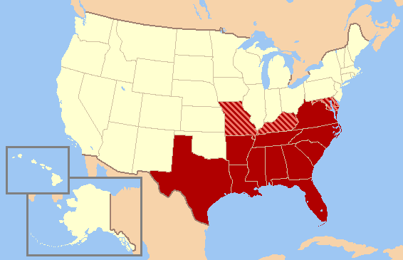
File:Southern United States Civil War map.png
外觀
Southern_United_States_Civil_War_map.png (566 × 365 像素,檔案大小:6 KB,MIME 類型:image/png)
檔案歷史
點選日期/時間以檢視該時間的檔案版本。
| 日期/時間 | 縮圖 | 尺寸 | 用戶 | 備註 | |
|---|---|---|---|---|---|
| 目前 | 2010年6月13日 (日) 22:13 |  | 566 × 365(6 KB) | Ras67 | cropped |
| 2007年2月11日 (日) 02:53 |  | 572 × 371(19 KB) | Gator87~commonswiki | Map of Historic Southern United States. States in red were in the Confederacy, whereas the striped states - Missouri, Kentucky, Maryland, and Delaware - were considered "Border States" that remained in the Union, though they gave varying degrees of suppo |
檔案用途
下列頁面有用到此檔案:
全域檔案使用狀況
以下其他 wiki 使用了這個檔案:
- eu.wikipedia.org 的使用狀況
- nl.wikipedia.org 的使用狀況
- simple.wikipedia.org 的使用狀況
- vi.wikipedia.org 的使用狀況


