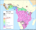
File:Map of the Atlantic–Congo languages.svg
外觀

此 SVG 檔案的 PNG 預覽的大小:717 × 600 像素。 其他解析度:287 × 240 像素 | 574 × 480 像素 | 918 × 768 像素 | 1,224 × 1,024 像素 | 2,447 × 2,048 像素 | 1,342 × 1,123 像素。
原始檔案 (SVG 檔案,表面大小:1,342 × 1,123 像素,檔案大小:1.07 MB)
檔案歷史
點選日期/時間以檢視該時間的檔案版本。
| 日期/時間 | 縮圖 | 尺寸 | 使用者 | 備註 | |
|---|---|---|---|---|---|
| 目前 | 2018年6月1日 (五) 20:57 |  | 1,342 × 1,123(1.07 MB) | SUM1 | Added note and fixed key |
| 2017年7月18日 (二) 15:20 |  | 1,342 × 1,123(1.07 MB) | SUM1 | Fixed southern Bantu boundary | |
| 2017年7月15日 (六) 22:00 |  | 1,342 × 1,123(1.08 MB) | SUM1 | Fixed Adamawa–Ubangi boundary | |
| 2017年7月12日 (三) 21:23 |  | 1,342 × 1,123(1.04 MB) | SUM1 | Added thin border around non-Atlantic–Congo shading | |
| 2017年7月10日 (一) 22:33 |  | 1,342 × 1,123(1.04 MB) | SUM1 | Added boundary around Ijoid | |
| 2017年7月10日 (一) 21:10 |  | 1,342 × 1,123(1.04 MB) | SUM1 | Fixed Kordofanian labels | |
| 2017年7月10日 (一) 19:54 |  | 1,342 × 1,123(1.04 MB) | SUM1 | Added border around shading | |
| 2017年7月10日 (一) 15:58 |  | 1,342 × 1,123(1.01 MB) | SUM1 | Fixed Bantu and Adamawa–Ubangi boundaries | |
| 2017年7月10日 (一) 01:08 |  | 1,342 × 1,123(1.01 MB) | SUM1 | Changed "classifications" to "groupings" | |
| 2017年7月10日 (一) 01:03 |  | 1,342 × 1,123(1.01 MB) | SUM1 | Combined uncombined paths and fixed colour |
檔案用途
下列頁面有用到此檔案:
全域檔案使用狀況
以下其他 wiki 使用了這個檔案:
- en.wikipedia.org 的使用狀況
- es.wikipedia.org 的使用狀況
- fa.wikipedia.org 的使用狀況
- ha.wikipedia.org 的使用狀況
- id.wikipedia.org 的使用狀況
- it.wikipedia.org 的使用狀況
- lt.wikipedia.org 的使用狀況
- tr.wikipedia.org 的使用狀況
- vi.wikipedia.org 的使用狀況

