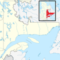
File:Canada Eastern Quebec location map.png
外觀

預覽大小:800 × 527 像素。 其他解析度:320 × 211 像素 | 640 × 422 像素。
原始檔案 (910 × 600 像素,檔案大小:176 KB,MIME 類型:image/png)
檔案歷史
點選日期/時間以檢視該時間的檔案版本。
| 日期/時間 | 縮圖 | 尺寸 | 使用者 | 備註 | |
|---|---|---|---|---|---|
| 目前 | 2013年5月2日 (四) 03:09 |  | 910 × 600(176 KB) | Gordalmighty | boundary fix |
| 2013年4月20日 (六) 00:49 |  | 875 × 590(136 KB) | Gordalmighty | Reverted to version as of 18:42, 19 April 2013 | |
| 2013年4月20日 (六) 00:49 |  | 1,135 × 1,135(406 KB) | Gordalmighty | Reverted to version as of 22:12, 15 April 2013 | |
| 2013年4月19日 (五) 18:42 |  | 875 × 590(136 KB) | Gordalmighty | made Cote-Nord into separate map, using this one for Gaspe/Bas-Saint-Laurent | |
| 2013年4月15日 (一) 22:12 |  | 1,135 × 1,135(406 KB) | Gordalmighty | User created page with UploadWizard |
檔案用途
下列3個頁面有用到此檔案:
全域檔案使用狀況
以下其他 wiki 使用了這個檔案:
- ar.wikipedia.org 的使用狀況
- ceb.wikipedia.org 的使用狀況
- en.wikipedia.org 的使用狀況
- Rimouski
- Saint-Louis-du-Ha! Ha!
- New Carlisle, Quebec
- Gaspé, Quebec
- Saint-Éloi, Quebec
- Rivière-du-Loup
- Les Îles-de-la-Madeleine, Quebec
- Chandler, Quebec
- Percé, Quebec
- Nouvelle, Quebec
- La Pocatière
- Kamouraska, Quebec
- Métis-sur-Mer
- Grand-Métis
- Mont-Joli
- Trois-Pistoles
- Rivière-Ouelle
- Cacouna
- Bonaventure, Quebec
- Amqui
- Murdochville
- L'Isle-Verte
- Cap-Chat
- Dégelis
- New Richmond, Quebec
- Pohénégamook
- Cloridorme
- Sainte-Jeanne-d'Arc, Bas-Saint-Laurent
- Pointe-à-la-Croix
- Paspébiac
- Baie-des-Sables
- Sainte-Florence, Quebec
- Matapédia, Quebec
- Val-Brillant
- Saint-Alexis-de-Matapédia
- Grande-Vallée
- Petite-Vallée
- Grande-Rivière, Quebec
- Port-Daniel–Gascons
- Sainte-Thérèse-de-Gaspé
- Sainte-Anne-des-Monts
- La Martre, Quebec
- Rivière-à-Claude
- Sainte-Madeleine-de-la-Rivière-Madeleine
- Caplan, Quebec
- Hope Town, Quebec
- Shigawake
- Grosse-Île, Quebec
檢視此檔案的更多全域使用狀況。


