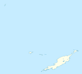
File:Anguilla location map.svg
外觀

此 SVG 檔案的 PNG 預覽的大小:664 × 599 像素。 其他解析度:266 × 240 像素 | 532 × 480 像素 | 851 × 768 像素 | 1,134 × 1,024 像素 | 2,269 × 2,048 像素 | 1,777 × 1,604 像素。
原始檔案 (SVG 檔案,表面大小:1,777 × 1,604 像素,檔案大小:56 KB)
檔案歷史
點選日期/時間以檢視該時間的檔案版本。
| 日期/時間 | 縮圖 | 尺寸 | 使用者 | 備註 | |
|---|---|---|---|---|---|
| 目前 | 2010年5月3日 (一) 18:34 |  | 1,777 × 1,604(56 KB) | NordNordWest | == {{int:filedesc}} == {{Information |Description= {{de|Positionskarte von Anguilla}} Geographische Begrenzung der Karte: * N: 18.62° N * S: 18.14° N * W: 63.46° W * O: 62.90° W {{en|Location map of Anguilla}} Geograp |
檔案用途
下列5個頁面有用到此檔案:
全域檔案使用狀況
以下其他 wiki 使用了這個檔案:
- af.wikipedia.org 的使用狀況
- an.wikipedia.org 的使用狀況
- ar.wikipedia.org 的使用狀況
- ast.wikipedia.org 的使用狀況
- ba.wikipedia.org 的使用狀況
- be-tarask.wikipedia.org 的使用狀況
- be.wikipedia.org 的使用狀況
- bg.wikipedia.org 的使用狀況
- bs.wikipedia.org 的使用狀況
- ceb.wikipedia.org 的使用狀況
- Anguilla
- Gumagamit:Lsj/Test
- Plantilya:Location map United Kingdom Anguilla
- Sandy Island
- Long Bay
- Great Bay
- Shoal Bay
- West Point
- West Cay
- Sandy Point
- Long Rock
- Little Island
- Blowing Rock
- Windward Point
- Warner Point
- The Valley
- Valley
- Stoney Bay
- Spring Bay
- Sombrero (pagklaro)
- Hat Island
- Sombrero Island
- Snake Point
- Lovers Point
- Seal Rocks
- Seal Island
- Seal Islets
- Seal Islands
- Scrub Island
- Scrub Islet
- Savannah Bay
- Sand Island
- Sandy Hill Bay
- Road Point
檢視此檔案的更多全域使用狀況。


