
File:161 Street entrance vc.jpg

原始檔案 (4,000 × 3,000 像素,檔案大小:2.51 MB,MIME 類型:image/jpeg)
摘要
| 描述 |
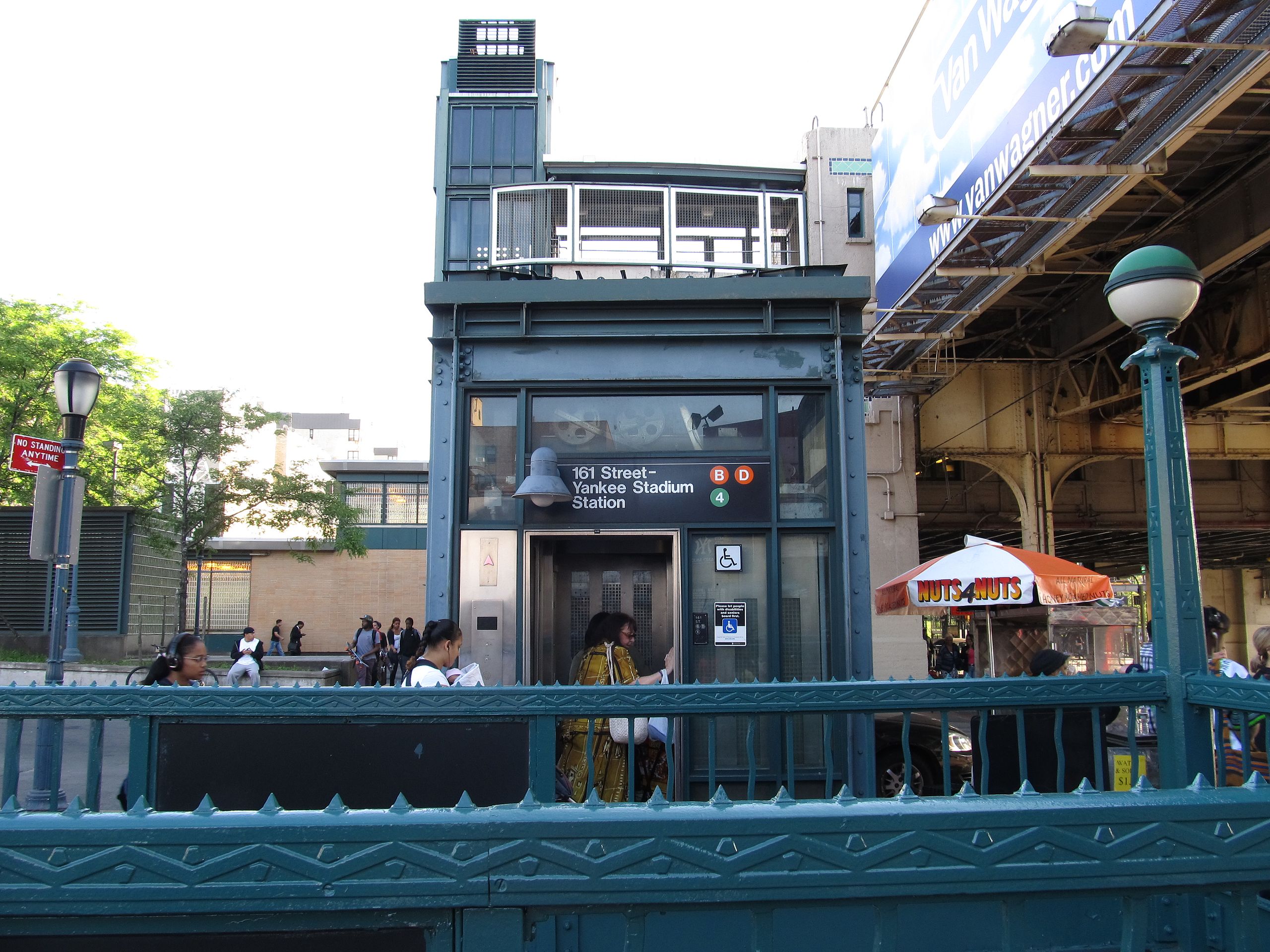
161st Street – Yankee Stadium is a New York City Subway station complex shared by the elevated IRT Jerome Avenue Line and the underground IND Concourse Line. Located at the intersection of 161st Street and River Avenue in the Bronx, it is served by the: 4 train at all times D train at all times except rush hours in the peak direction B train during rush hours Yankee Stadium is outside and many Bronx County courts, government facilities, and shopping districts are a short walk to the east. (Yankee Stadium is also accessible via the MTA's Metro-North via the Yankees – East 153rd Street station.) This is one of only two station complexes in The Bronx (the other being 149th Street – Grand Concourse). When the IND portion was built in 1933, paper tickets were used to transfer between the two lines; this method was used until the 1950s, when the indoor escalators were built. The complex has been fully renovated to include ADA-accessible elevators to all platforms. The combined passenger count for the complex in 2011 was 8,605,893, making it the busiest station in the Bronx and 36th overall. en.wikipedia.org/wiki/161st_Street_%E2%80%93_Yankee_Stadium_(New_York_City_Subway) en.wikipedia.org/wiki/Wikipedia:Text_of_Creative_Commons_... |
| 日期 | |
| 來源 | 161st Street – Yankee Stadium Station, The Bronx, New York |
| 作者 | Ken Lund from Las Vegas, Nevada, USA |
| 拍攝地點 | | 位於此地的本圖片與其他圖片: OpenStreetMap |
|---|
授權條款
- 您可以自由:
- 分享 – 複製、發佈和傳播本作品
- 重新修改 – 創作演繹作品
- 惟需遵照下列條件:
- 姓名標示 – 您必須指名出正確的製作者,和提供授權條款的連結,以及表示是否有對內容上做出變更。您可以用任何合理的方式來行動,但不得以任何方式表明授權條款是對您許可或是由您所使用。
- 相同方式分享 – 如果您利用本素材進行再混合、轉換或創作,您必須基於如同原先的相同或兼容的條款,來分布您的貢獻成品。
| 這幅圖片原始出處為Flickr的https://www.flickr.com/photos/75683070@N00/7237820616 ,作者為Ken Lund 。經機器人FlickreviewR在2014年10月3日審查後確定為採用cc-by-sa-2.0的協議授權使用。 |
檔案歷史
點選日期/時間以檢視該時間的檔案版本。
| 日期/時間 | 縮圖 | 尺寸 | 使用者 | 備註 | |
|---|---|---|---|---|---|
| 目前 | 2014年9月30日 (二) 17:36 | | 4,000 × 3,000(2.51 MB) | Vcohen | Transferred from Flickr via Flickr2commons |
檔案用途
下列頁面有用到此檔案:
全域檔案使用狀況
以下其他 wiki 使用了這個檔案:
- en.wikipedia.org 的使用狀況
- it.wikipedia.org 的使用狀況
- ja.wikipedia.org 的使用狀況
- ru.wikipedia.org 的使用狀況