
File:Us canada eu 2007.png
没有更高的分辨率。
Us_canada_eu_2007.png (738 × 375像素,文件大小:20 KB,MIME类型:image/png)
摘要
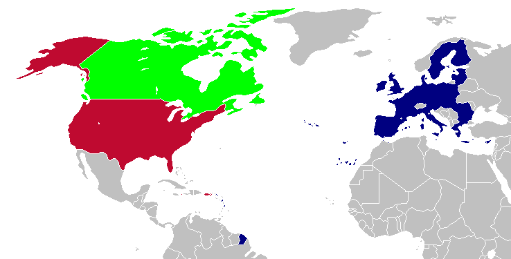
This is a map of the US, Canada and the EU for use after Romania and Bulgaria join the EU in 2007. The map is the same as en:Image:Us canada eu.png; however French Guiana and Puerto Rico have been added. This map is based off of Image:BlankMap-World-v5-EU.png.
许可协议

|
已授权您依据自由软件基金会发行的无固定段落及封面封底文字(Invariant Sections, Front-Cover Texts, and Back-Cover Texts)的GNU自由文件许可协议1.2版或任意后续版本的条款,复制、传播和/或修改本文件。该协议的副本请见“GNU Free Documentation License”。 |
| 本文件采用知识共享署名-相同方式共享 3.0 未本地化版本许可协议授权。 | ||
| ||
| 本许可协议标签作为GFDL许可协议更新的组成部分被添加至本文件。 |
| 本作品已被作者Hoshie释出到公有领域。这适用于全世界。 在一些国家这可能不合法;如果是这样的话,那么: |
文件历史
点击某个日期/时间查看对应时刻的文件。
| 日期/时间 | 缩略图 | 大小 | 用户 | 备注 | |
|---|---|---|---|---|---|
| 当前 | 2008年4月12日 (六) 23:28 | | 738 × 375(20 KB) | Hoshie | St. Barts and St. Martin are in the EU |
| 2007年3月6日 (二) 03:58 |  | 738 × 375(20 KB) | Hoshie | added more details of places in and out of the EU. | |
| 2006年12月13日 (三) 20:51 |  | 703 × 363(18 KB) | Hoshie | Fixed an island off of Alaska. under same license as original. | |
| 2006年11月18日 (六) 04:06 |  | 703 × 363(18 KB) | Hoshie | This is a map of the US, Canada and the EU for use after Romania and Bulgaria join the EU in 2007. The map is the same as en:Image:Us canada eu.png; however French Guiana and Puerto Rico have been added. This map is based off of [[:Image:BlankMap-Wor |
文件用途
以下页面使用本文件:
全域文件用途
以下其他wiki使用此文件:
- en.wikipedia.org上的用途
- es.wikipedia.org上的用途
- uk.wikipedia.org上的用途