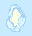
File:Wallis location map.svg
外观

此SVG文件的PNG预览的大小:531 × 600像素。 其他分辨率:212 × 240像素 | 425 × 480像素 | 680 × 768像素 | 907 × 1,024像素 | 1,813 × 2,048像素 | 1,082 × 1,222像素。
原始文件 (SVG文件,尺寸为1,082 × 1,222像素,文件大小:146 KB)
文件历史
点击某个日期/时间查看对应时刻的文件。
| 日期/时间 | 缩略图 | 大小 | 用户 | 备注 | |
|---|---|---|---|---|---|
| 当前 | 2010年7月11日 (日) 02:24 |  | 1,082 × 1,222(146 KB) | Sting | Simplifying reef color scheme |
| 2010年7月10日 (六) 22:09 |  | 1,082 × 1,222(147 KB) | Sting | == {{int:filedesc}} == {{Location|13|17|15|S|176|12|00|W|scale:100000}} <br/> {{Information |Description={{en|Blank administrative map of Wallis Island, part of the French overseas collectivity of |
文件用途
全域文件用途
以下其他wiki使用此文件:
- ar.wikipedia.org上的用途
- be-tarask.wikipedia.org上的用途
- bn.wikipedia.org上的用途
- ceb.wikipedia.org上的用途
- de.wikipedia.org上的用途
- Mata Utu
- Wikipedia:Kartenwerkstatt/Positionskarten/Australien und Ozeanien
- Vorlage:Positionskarte Wallis-Inseln
- Flughafen Wallis-Hihifo
- Vorlage:Positionskarte Wallis
- Vaitupu (Wallis und Futuna)
- Alele
- Malaʻe (Uvea)
- Vailala
- Tufuʻone
- Liku (Wallis und Futuna)
- Falaleu
- Akaʻaka
- Ahoa
- Haʻafuasia
- Malaʻefoʻou
- Utufua
- Halalo
- Vaimalau
- Lavegahau
- Teʻesi
- Gahi
- Haʻatofo
- Tepa (Wallis und Futuna)
- Kolopopo
- el.wikipedia.org上的用途
- en.wikipedia.org上的用途
查看此文件的更多全域用途。


