
File:Aerial view of Pawpaw Area from NPS exhibit.jpg

本预览的尺寸:800 × 598像素。 其他分辨率:320 × 239像素 | 640 × 478像素 | 1,024 × 765像素 | 1,280 × 956像素 | 2,560 × 1,912像素 | 3,936 × 2,940像素。
原始文件 (3,936 × 2,940像素,文件大小:6.07 MB,MIME类型:image/jpeg)
摘要
| 描述 |
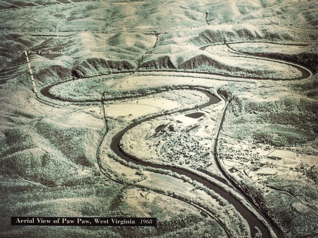
English: Aerial view of the Paw Paw, West Virginia area, showing location of the Paw Paw Tunnel on the Chesapeake and Ohio Canal. The cliffs on the Maryland side of the Potomac River were the reason that the canal engineers (mainly Charles B Fisk) built the tunnel. |
|||
| 日期 | ||||
| 来源 | U.S. National Park Service, Canal Place museum, Cumberland, Maryland. | |||
| 作者 | National Park Service | |||
| 授权 (二次使用本文件) |
|
文件历史
点击某个日期/时间查看对应时刻的文件。
| 日期/时间 | 缩略图 | 大小 | 用户 | 备注 | |
|---|---|---|---|---|---|
| 当前 | 2014年8月1日 (五) 14:07 | | 3,936 × 2,940(6.07 MB) | Bonnachoven | {{Information |Description ={{en|1=Aerial view of the Pawpaw area, showing place where Pawpaw tunnel is. Note on the MD side of the river, the cliffs which were the reason for the canal engineers (mainly Charles B Fisk) to build the tunnel. }} |Sour... |
文件用途
以下页面使用本文件:
全域文件用途
以下其他wiki使用此文件:
- en.wikipedia.org上的用途