
File:Patagonia aerial.jpg
本预览的尺寸:800 × 600像素。 其他分辨率:320 × 240像素 | 640 × 480像素 | 1,024 × 768像素 | 1,280 × 960像素 | 2,592 × 1,944像素。
原始文件 (2,592 × 1,944像素,文件大小:4.23 MB,MIME类型:image/jpeg)
| 描述 |
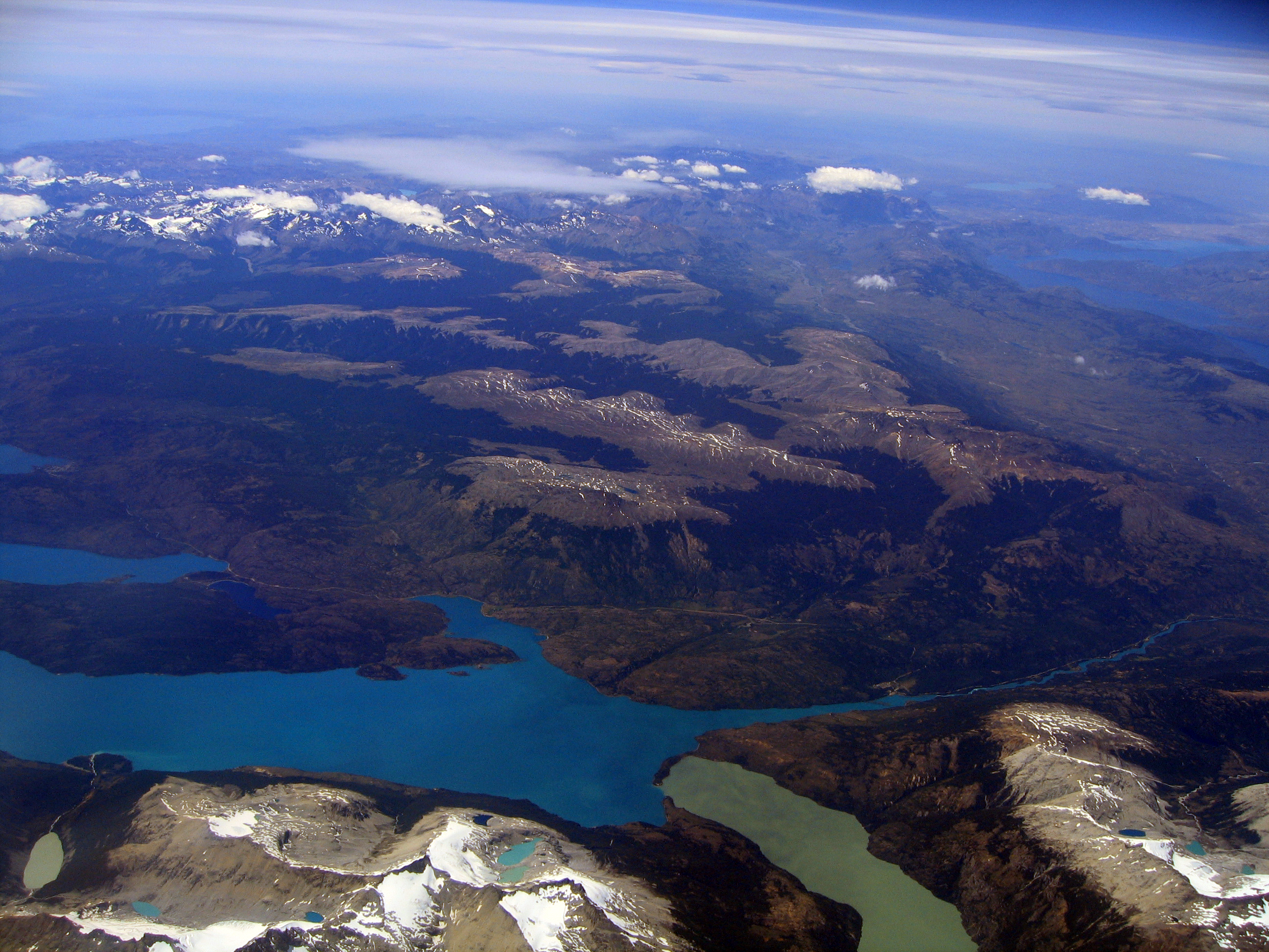
English: Aerial photo of an area in Patagonia, taken from a plane flying from Santiago de Chile to Punta Arenas) |
||
| 日期 | |||
| 来源 | 自己的作品 | ||
| 作者 | Entropy1963 | ||
| 授权 (二次使用本文件) |
|
| 相机位置 | | 在以下服务上查看本图像和附近其他图像: OpenStreetMap |
|---|
文件历史
点击某个日期/时间查看对应时刻的文件。
| 日期/时间 | 缩略图 | 大小 | 用户 | 备注 | |
|---|---|---|---|---|---|
| 当前 | 2011年1月14日 (五) 10:38 | | 2,592 × 1,944(4.23 MB) | Entropy1963 | {{Information |Description={{en|1=Aerial photo of an area in Patagonia, taken from a plane flying from Santiago de Chile to Punta Arenas)}} |Source={{own}} |Author=Entropy1963 |Date=2008-12-28 |Permission={{PD-self}} |other_versions= |
文件用途
以下页面使用本文件:
全域文件用途
以下其他wiki使用此文件:
- ceb.wikipedia.org上的用途
- el.wikipedia.org上的用途
- en.wikipedia.org上的用途
- es.wikipedia.org上的用途
- eu.wikipedia.org上的用途
- pt.wikipedia.org上的用途
- ru.wikipedia.org上的用途
- sv.wikipedia.org上的用途
- www.wikidata.org上的用途