
File:North Yorkshire UK relief location map.jpg

本预览的尺寸:800 × 582像素。 其他分辨率:320 × 233像素 | 640 × 466像素 | 1,024 × 745像素 | 1,280 × 932像素 | 1,999 × 1,455像素。
原始文件 (1,999 × 1,455像素,文件大小:466 KB,MIME类型:image/jpeg)
| 描述 |
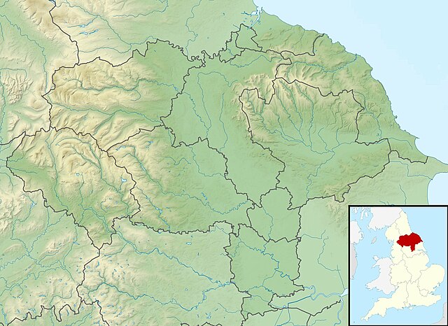
Relief map of North Yorkshire, UK. Equirectangular map projection on WGS 84 datum, with N/S stretched 170% Geographic limits:
|
| 日期 | |
| 来源 |
|
| 作者 | Nilfanion, created using Ordnance Survey data |
| 授权 (二次使用本文件) |
本文件采用知识共享署名-相同方式共享 3.0 未本地化版本许可协议授权。 署名: Contains Ordnance Survey data © Crown copyright and database right
|
| 其他版本 | File:North Yorkshire UK district map (blank).svg - Blank map |
.svg)
文件历史
点击某个日期/时间查看对应时刻的文件。
| 日期/时间 | 缩略图 | 大小 | 用户 | 备注 | |
|---|---|---|---|---|---|
| 当前 | 2011年11月29日 (二) 01:47 | | 1,999 × 1,455(466 KB) | Nilfanion | {{Information |Description=Relief map of North Yorkshire, UK. Equirectangular map projection on WGS 84 datum, with N/S stretched 170% Geographic limits: *West: 2.60W *East: 0.10W *North: 54.67N *South: 53.60N |Source=[[w:Ordnance S |
文件用途
以下页面使用本文件:
全域文件用途
以下其他wiki使用此文件:
- ar.wikipedia.org上的用途
- bg.wikipedia.org上的用途
- ceb.wikipedia.org上的用途
- da.wikipedia.org上的用途
- en.wikipedia.org上的用途
- Battle of Marston Moor
- Roseberry Topping
- River Esk, North Yorkshire
- Studley Royal Park
- Cock Beck
- Tan Hill, North Yorkshire
- Malham Tarn
- Siege of York
- Roundhill Reservoir
- Angram Reservoir
- Scar House Reservoir
- Cod Beck Reservoir
- Boulby Quarries
- Langbaurgh Ridge
- Lovell Hill Pools
- Saltburn Gill
- Pinkney and Gerrick Woods
- Redcar Rocks
- South Gare & Coatham Sands SSSI
- Semerwater
- Fewston Reservoir
- Swinsty Reservoir
- Thruscross Reservoir
- Winterburn Reservoir
- Lindley Wood Reservoir
- Newby Hall
- British PGA Matchplay Championship
- Gouthwaite Reservoir
- Leighton Reservoir
- Thornton Steward Reservoir
- Scarborough Mere
- Gragareth
- River Seven
- Ganton Golf Club
- Grimwith Reservoir
- Embsay Reservoir
- Great Stone of Fourstones
- Chelker Reservoir
- Murphy's Cup
- Guildford Slingsby
- Bishopdale Beck
查看此文件的更多全域用途。