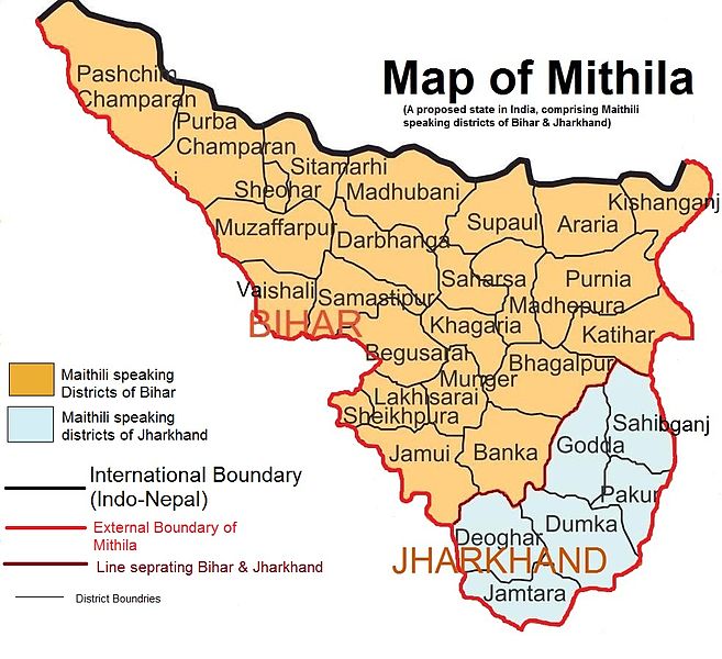
File:Mithila Map.jpg
外观

本预览的尺寸:657 × 600像素。 其他分辨率:263 × 240像素 | 526 × 480像素 | 983 × 897像素。
原始文件 (983 × 897像素,文件大小:248 KB,MIME类型:image/jpeg)
文件历史
点击某个日期/时间查看对应时刻的文件。
| 日期/时间 | 缩略图 | 大小 | 用户 | 备注 | |
|---|---|---|---|---|---|
| 当前 | 2012年4月25日 (三) 17:22 |  | 983 × 897(248 KB) | Vikas11004315 | {{subst:Upload marker added by en.wp UW}} {{Information |Description = {{en|Map showing Maithili speaking region of India which is proposed for Mithila State. I covers 24 districts of Bihar and 6 districts of Jharkhand}} |Source = It is created using M... |
文件用途
以下页面使用本文件:
全域文件用途
以下其他wiki使用此文件:
- bn.wikipedia.org上的用途
- de.wikipedia.org上的用途
- en.wikipedia.org上的用途
- id.wikipedia.org上的用途
- ja.wikipedia.org上的用途
- ko.wikipedia.org上的用途
- ml.wikipedia.org上的用途
- nn.wikipedia.org上的用途
- ru.wikipedia.org上的用途
- sv.wikipedia.org上的用途
- ta.wikipedia.org上的用途
- te.wikipedia.org上的用途
- uk.wikipedia.org上的用途
- www.wikidata.org上的用途


