
File:Matekaneairrunway.jpg

本预览的尺寸:442 × 599像素。 其他分辨率:177 × 240像素 | 354 × 480像素 | 566 × 768像素 | 755 × 1,024像素 | 1,510 × 2,048像素 | 3,425 × 4,645像素。
原始文件 (3,425 × 4,645像素,文件大小:857 KB,MIME类型:image/jpeg)
| 描述 |
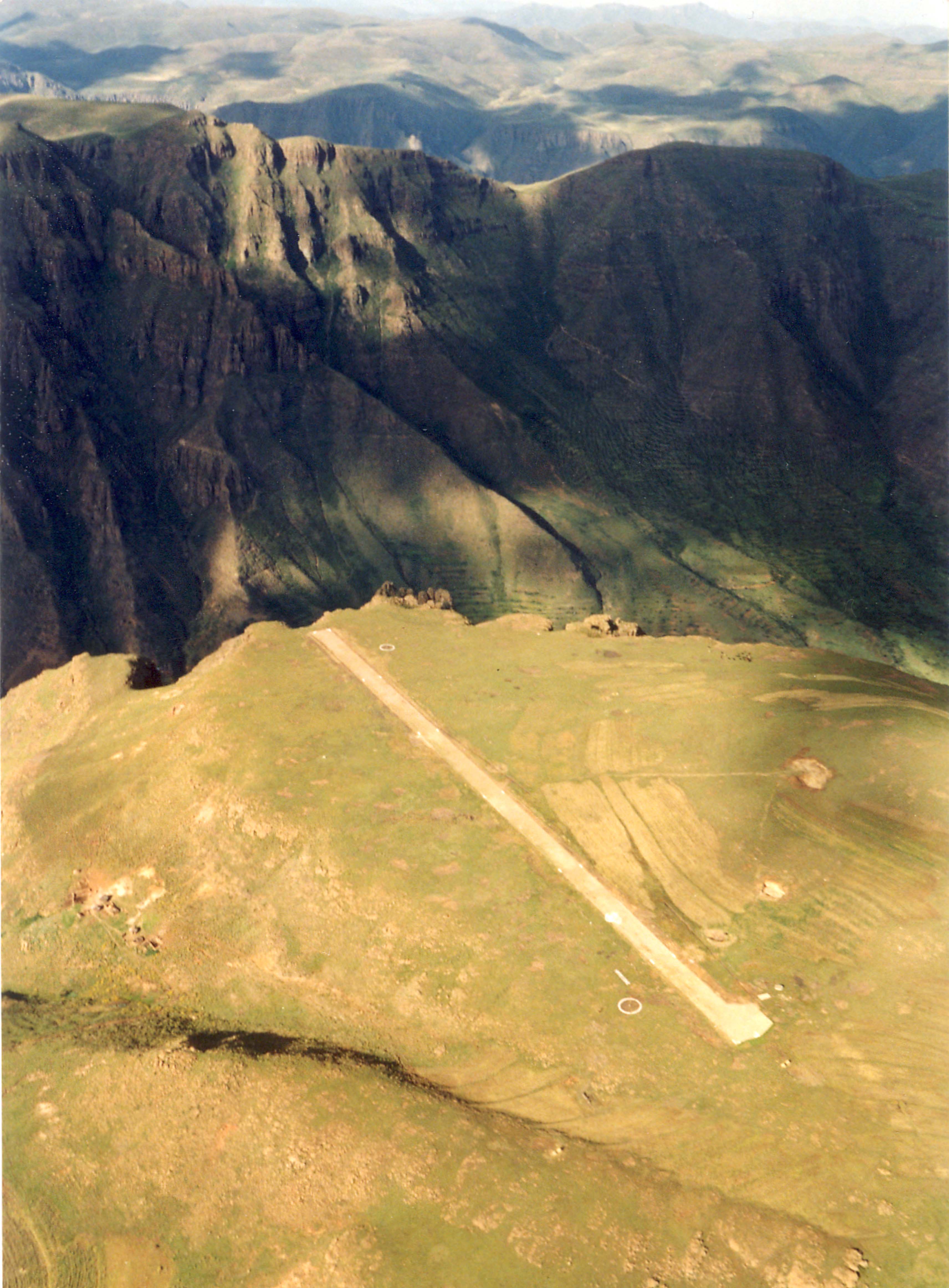
English: The airstrip at Matekane (ICAO: FXME) |
| 日期 | |
| 来源 | http://www.claytor.com/photographs/ (http://www.claytor.com/photographs/images/picLesothoMatekaneAirstripTomClaytor.jpg) |
| 作者 | Tom Claytor; http://www.claytor.com |
| 授权 (二次使用本文件) |
http://www.claytor.com/photographs/ |
| 物体位置 | | 在以下服务上查看本图像和附近其他图像: OpenStreetMap |
|---|
许可协议
原始上传日志
本檔案是由OhanaUnited從en.wikipedia轉移到維基共享資源。
原始描述頁面位於這裡。下列使用者名稱均來自en.wikipedia。
- 2009-02-26 21:05 Einsteinbud 3425×4645× (877606 bytes) {{Information |Description= The airstrip at Matekane |Source= http://www.claytor.com/photographs/images/picLesothoMatekaneAirstripTomClaytor.jpg |Date= |Author= Tom Claytor |Permission= released on public domain |other_versions= }}
文件历史
点击某个日期/时间查看对应时刻的文件。
| 日期/时间 | 缩略图 | 大小 | 用户 | 备注 | |
|---|---|---|---|---|---|
| 当前 | 2009年11月15日 (日) 22:42 | | 3,425 × 4,645(857 KB) | OhanaUnited | {{Information |Description={{en|The airstrip at Matekane}} |Source=Transferred from [http://en.wikipedia.org en.wikipedia]; transfer was stated to be made by User:OhanaUnited.<br/> (Original text : ''http://www.claytor.com/photographs/images/picLesoth |
文件用途
以下页面使用本文件:
全域文件用途
以下其他wiki使用此文件:
- ast.wikipedia.org上的用途
- en.wikipedia.org上的用途
- es.wikipedia.org上的用途
- fa.wikipedia.org上的用途
- fr.wikipedia.org上的用途
- hu.wikipedia.org上的用途
- hu.wikibooks.org上的用途
- ja.wikipedia.org上的用途
- nl.wikipedia.org上的用途
- pl.wikipedia.org上的用途
- ru.wikipedia.org上的用途
- tg.wikipedia.org上的用途
- www.wikidata.org上的用途