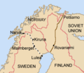
File:Lapland1940.png
外观
Lapland1940.png (339 × 293像素,文件大小:18 KB,MIME类型:image/png)
文件历史
点击某个日期/时间查看对应时刻的文件。
| 日期/时间 | 缩略图 | 大小 | 用户 | 备注 | |
|---|---|---|---|---|---|
| 当前 | 2016年2月5日 (五) 16:24 |  | 339 × 293(18 KB) | Hohum | Clearer for nations, route |
| 2009年11月9日 (一) 20:49 |  | 339 × 293(8 KB) | NuclearWarfare | Reverted to version as of 05:50, 13 February 2007 | |
| 2009年11月9日 (一) 20:49 |  | 339 × 293(11 KB) | File Upload Bot (Magnus Manske) | {{BotMoveToCommons|en.wikipedia|year={{subst:CURRENTYEAR}}|month={{subst:CURRENTMONTHNAME}}|day={{subst:CURRENTDAY}}}} {{Information |Description={{en|Based on Brion Vibber's map of Europe. [http://leuksman.com/misc/maps.php which can be found here]}} | | |
| 2007年2月13日 (二) 05:50 |  | 339 × 293(8 KB) | Tene~commonswiki | Optimised (0;320;r) | |
| 2005年8月17日 (三) 06:25 |  | 339 × 293(11 KB) | Stephan Herz | Based on Brion Vibber's map of Europe. [http://leuksman.com/misc/maps.php which can be found here] {{GFDL}} |
文件用途
以下3个页面使用本文件:
全域文件用途
以下其他wiki使用此文件:
- azb.wikipedia.org上的用途
- bg.wikipedia.org上的用途
- da.wikipedia.org上的用途
- el.wikipedia.org上的用途
- en.wikipedia.org上的用途
- Winter War
- Narvik Municipality
- User talk:Jniemenmaa
- Battles of Narvik
- Sweden during World War II
- User:Jniemenmaa/images
- Swedish iron-ore industry during World War II
- Sweden and the Winter War
- Operation Wilfred
- User talk:Johan Magnus/Archive 1
- Plan R 4
- User:Realpolitik agenda/SdWWII
- Franco-British plans for intervention in the Winter War
- Operation Weserübung
- User:Vaoro/Norway-Finland
- Blockade of Germany (1939–1945)
- Narvik (town)
- User:Åkebråke/sandbox
- User:Falcaorib/Russia and Soviet Union
- User:Falcaorib/Sweden and Finland
- es.wikipedia.org上的用途
- fa.wikipedia.org上的用途
- fi.wikipedia.org上的用途
- fr.wikipedia.org上的用途
- fy.wikipedia.org上的用途
- gl.wikipedia.org上的用途
- hu.wikipedia.org上的用途
- id.wikipedia.org上的用途
- it.wikipedia.org上的用途
- ja.wikipedia.org上的用途
- ka.wikipedia.org上的用途
- mk.wikipedia.org上的用途
- nl.wikipedia.org上的用途
- no.wikipedia.org上的用途
查看此文件的更多全域用途。


