
File:Aorounga Impact Crater, Chad.jpg
原始文件 (1,440 × 960像素,文件大小:472 KB,MIME类型:image/jpeg)
摘要
| 描述 |
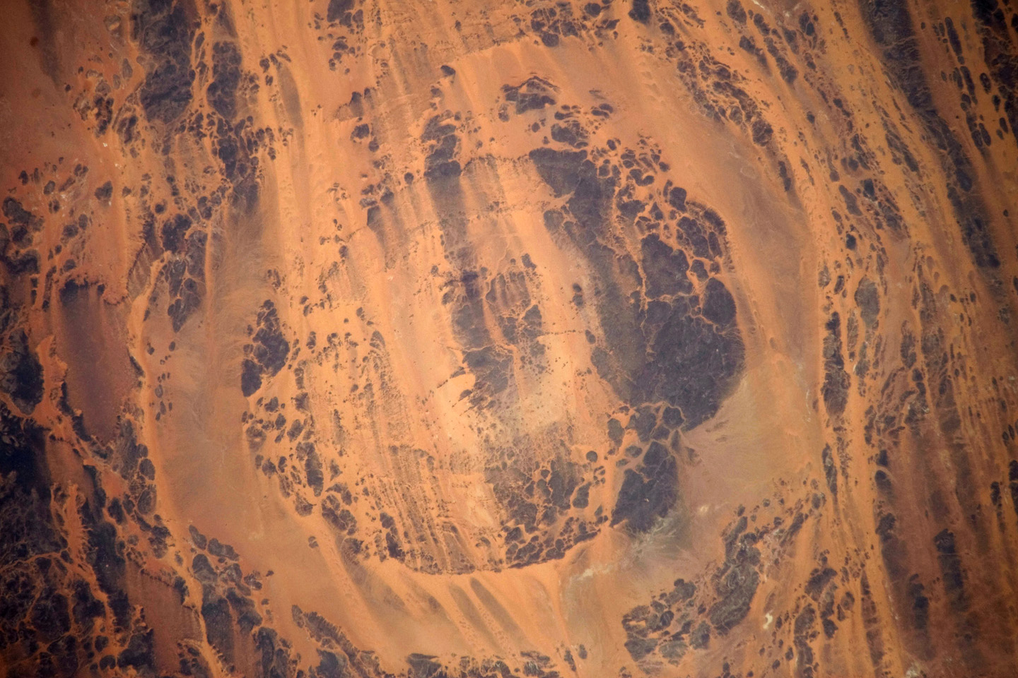
English: The concentric ring structure of the Aorounga crater—renamed Aorounga South in the multiple-crater interpretation of SIR data—is clearly visible in this detailed astronaut photograph. The central highland, or peak, of the crater is surrounded by a small sand-filled trough; this in turn is surrounded by a larger circular trough. Linear rock ridges alternating with light orange sand deposits cross the image from upper left to lower right; these are called yardangs by geomorphologists. Yardangs form by wind erosion of exposed rock layers in a unidirectional wind field. The wind blows from the north-east at Aorounga, and sand dunes formed between the yardangs are actively migrating to the south-west.
|
||||||||||||||||||||||||||||||||||||||||||||||||||||||
| 日期 | |||||||||||||||||||||||||||||||||||||||||||||||||||||||
| 来源 | NASA Earth Observatory | ||||||||||||||||||||||||||||||||||||||||||||||||||||||
| 作者 |
|
||||||||||||||||||||||||||||||||||||||||||||||||||||||
| 其他版本 |
|
||||||||||||||||||||||||||||||||||||||||||||||||||||||

本图像或视频收录于美国国家航空航天局 (NASA)休斯顿太空中心(Johnson Space Center),其照片编号是: ISS020-E-026195 此标签不表示文件的著作权状态。任何文件在附有此标签的同時还需要一个有效的著作权标签。请参阅许可协议说明页面以了解更多信息。 其他语言:
|
Image acquired with a Nikon D3 digital camera fitted with an 800 mm lens, and is provided by the ISS Crew Earth Observations experiment and Image Science & Analysis Laboratory, Johnson Space Centre.
许可协议
| 本文件完全由NASA创作,在美国属于公有领域。根据NASA的版权方针,NASA的材料除非另有声明否则不受版权保护。(参见Template:PD-USGov/zh、NASA版权方针页面或JPL图片使用方针。) | ||
 |
警告:
|
文件历史
点击某个日期/时间查看对应时刻的文件。
| 日期/时间 | 缩略图 | 大小 | 用户 | 备注 | |
|---|---|---|---|---|---|
| 当前 | 2009年8月10日 (一) 09:02 | | 1,440 × 960(472 KB) | Originalwana | {{Information |Description={{en|1=The concentric ring structure of the Aorounga crater—renamed Aorounga South in the multiple-crater interpretation of SIR data—is clearly visible in this detailed astronaut photograph. The central highland, or peak, of |
文件用途
以下页面使用本文件:
全域文件用途
以下其他wiki使用此文件:
- de.wikipedia.org上的用途
- en.wikipedia.org上的用途
- it.wikipedia.org上的用途
- kk.wikipedia.org上的用途
- lt.wikipedia.org上的用途
- ro.wikipedia.org上的用途
- ru.wikipedia.org上的用途